
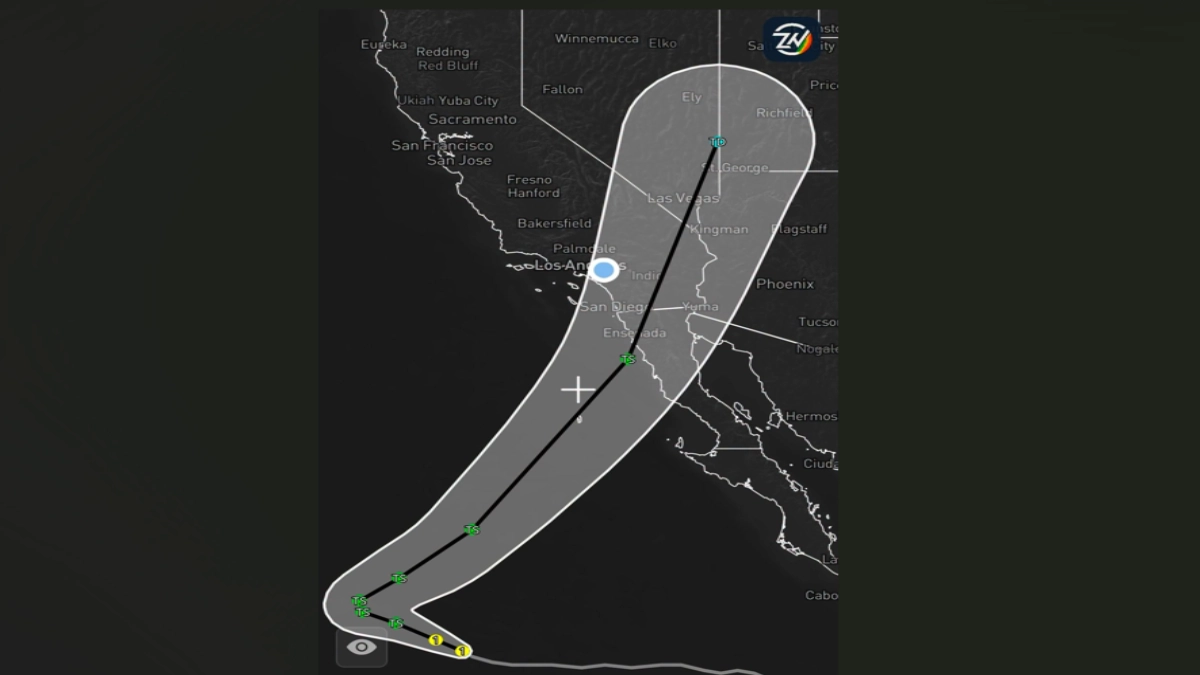
SOUTHERN CALIFORNIA, CA. (Pain In The Pass) >> Southern California Weather Force said, on Wednesday with extended the forecast for Hurricane Rachel path into Southern California and in Arizona by Sunday morning.
As a low-pressure system will drop down on Friday into Saturday this will swing Rachel’s quickly up in California and in Arizona. This providing heavy rain showers and thunderstorms with gusty winds.
While it won’t be a hurricane by the time it reaches California or Arizona this weekend, Rachel will be a Tropical Storm Remnants. Time of rain showers will be early Sunday morning and last until Monday.
There won’t be a great deal of heavy rainfall with this storm, but clouds will cover the whole day on Sunday and parts of Monday.
Estimated rainfall totals are expected to be about a ¼ to ½ inch in the Inland Empire cities. Foothills and mountains communities estimated rainfall totals are expected to be about a ½ to an inch. The high desert cities estimated rainfall totals are expected to be about a trace to ¼ inch. A thunderstorm cell could produce more rainfall than estimated.
If you travel through the Cajon Pass and the Inland Empire you can expect traffic due to the weather condition that can change quickly. Remember to SLOW DOWN in the rain or in blowing dust.
Estimated gusty wind is expected to be 30 to 50 mph gusts in SoCal and start on Saturday-Monday.
With weather updates from the Southern California Weather Force and the Zone Watch app. They will post updates on the weather, so join both.
There are more ways to follow the Pain In The Pass. Join the Traffic Group on Facebook with over 173,000 members. Join the group on MeWe. Like us on the on Facebook. Follow us on Instagram, and also follow us on Threads, and X aka Twitter.
If you do get into an accident, click or call the trusted professionals of Lerner, Moore, Silva, Cunningham & Rubel Professional Law Corporation.