CAJON PASS, CA. (Pain In The Pass) >> Widespread Showers and Thunderstorms Activity Across Southern California starts on Tuesday through Saturday.
Southern California Weather Force has issued a Special Weather Statement as once again be in the firing zone for showers and thunderstorms, some severe, as a strong monsoon flow enters the area during the first week of September.
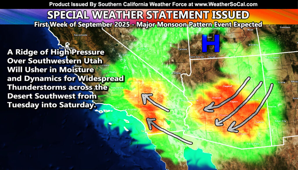
A complex atmosphere will be developing across the Southwestern United States starting on Monday. A ridge of high pressure will form over Utah. When this happens, the clockwise flow around it brings monsoon moisture and upper dynamics out of Mexico and into Southern California.
On Tuesday, expecting moisture to enter SoCal during the early morning hours across the region.
As Wednesday through Friday hits, we will have numerous thunderstorms in the area. This will develop a complex pattern in which there is no actual ridge of high pressure anymore, but more of multiple mini-low pressure centers across the area.
This scenario would bring an explosive thunderstorm event for the low and high desert, all of the mountains, Inland Empire valley, and even as far as the coasts of Los Angeles, Orange, San Diego County, and of course this includes the Cajon Pass.
A multi-day thunderstorm event is expected, which will be the strongest monsoon moisture flow impact this season thus far.
Southern California Weather Force will be on standby during the morning hours each day to issue any thunderstorm or severe thunderstorm watches or warnings for the app/email system between 9-10am and noon for social media.
Each day the storms may and will produce dry lighting and could spark a wildfire.
There are more ways to follow the Pain In The Pass. Join the Traffic Group on Facebook with over 163,000 members. Join the group on MeWe. Like us on the NEW page on Facebook. Follow us on Instagram, and also follow us on Threads, and X aka Twitter.