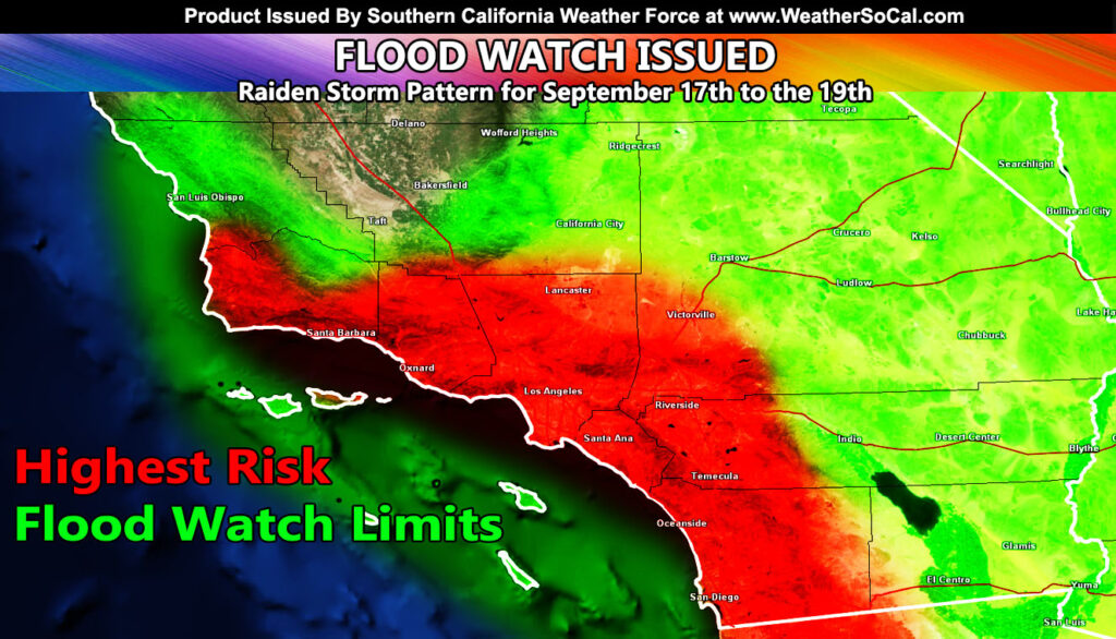
SOUTHERN CALIFORNIA, CA. (Pain In The Pass) >> A low-pressure system hanging off the coast of California and from a dying Tropical Storm Mario down in Baja Mexico is expected to bring a couple days of rainfall with thunderstorms and potential flash flooding to parts of California.
The Southern California Weather Force has issued a Flood Watch for Southern California on Wednesday September 17 through Friday Sept. 19. The peak rainfall day will be on Thursday.
This isn’t a normal ‘monsoon’ burst for the mountain and desert areas, SCWF said.
The rain showers and thunderstorms should clear out by Saturday.
Check with the Southern California Weather Force on late Tuesday or Wednesday morning from up-to-date information on the timing and rainfall totals.
There are more ways to follow the Pain In The Pass. Join the Traffic Group on Facebook with over 163,000 members. Join the group on MeWe. Like us on the NEW page on Facebook. Follow us on Instagram, and also follow us on Threads, and X aka Twitter.