CAJON PASS, CA. (Pain In The Pass) >> The first winter storm of 2025-2026 season will hit Southern California on Monday night into Tuesday. Yes, it will be raining on and off all day on Tuesday, the bulk of the storm will hit during the morning commute.
This weather event will bring mostly moderate to heavy rain showers on Tuesday, with the heaviest rain showers in the morning. Scattered rain showers for Tuesday afternoon/evening.
Flash flooding and dangerous debris flows are possible in the burn scars area. Wrightwood is in the Flash Flooding zone with Sheep Creek could overflow at Highway 2 or on Desert Front Road and in Phelan.
Southern California Weather Force has issued a Flood Watch what will probably turn into a Warning across the forecast zones. Mountain areas will have a high snow level so this means more rain that can lead into flash flooding.
The heaviest downpours or thunderstorms can have the potential to bring a quick 1+ inch of rain from a strong weather cell. The risk for localized flash flooding is moderate to high, with the burn land in the burn scars areas from brush fires from earlier in the year or from last year.

The Southern California Weather Force has posted the timing of the storm for the Inland Empire, Cajon Pass, mountains area, and the high desert below.
Timing for Inland Empire/Cajon Pass. Rain showers could start around 8pm-10pm Monday late night into Tuesday morning. The heaviest rain fall will start in the morning around 4am last into the afternoon. Off and on showers Tuesday afternoon and evening. Heavy fog/rain in the Cajon Pass. The Cajon Pass/foothills could get about 3+ inches of rain total. The Inland Empire cities could get about an inch to 2 inches of rain total; each city could vary. A thunderstorm can product higher rain total. Gusty winds will be blowing.
Timing of the storm for the High Desert. The rain showers could start around 9pm-11pm Monday late night into Tuesday morning with rain showers that could be heavy at time. The High Desert cities could get about an inch to 1+ inches of rain total; each city could vary. Barstow will get about an inch. Strong gusty winds.
Timing of the storm for the Wrightwood Mountains. Rain showers could start around 8pm-11pm Monday late night into Tuesday morning with heavy rain showers around 4am. Tuesday morning will be heaviest rain showers. Snow level will be high around 7,000 ft. Wrightwood will get about 3+ inches of rain total. Flash floods and dangerous debris flows are possible in Sheep Creek Wash in Wrightwood and in Phelan. Strong gusty winds are in the forecast.
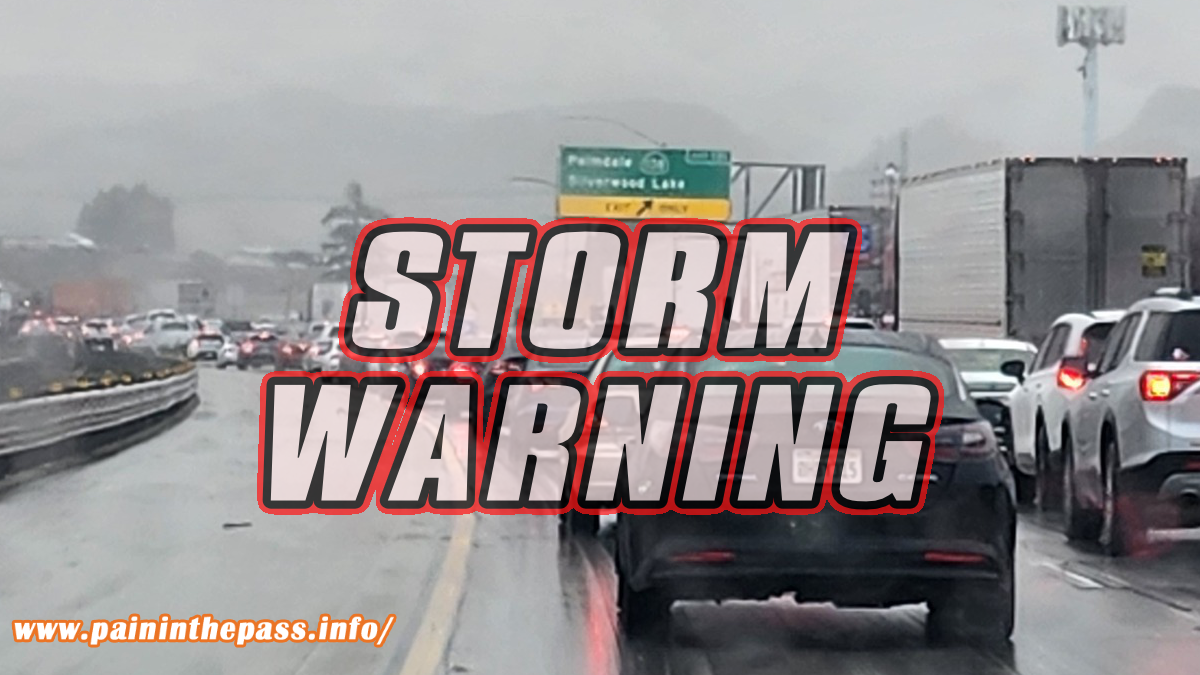
If you travel through the Cajon Pass expect heavy traffic due to the weather condition that can change quickly. One-minute light rain then the next minute heavy rain. Remember to SLOW DOWN in the rain or in foggy conditions.
Remember Head Lights on in the rain in the daytime.
Slow down to maintain control and leave space between vehicles.
Timing of the storm could change.
There are more ways to follow the Pain In The Pass. Join the Traffic Group on Facebook with over 164,000 members. Join the group on MeWe. Like us on the NEW page on Facebook. Follow us on Instagram, and also follow us on Threads, and X aka Twitter.