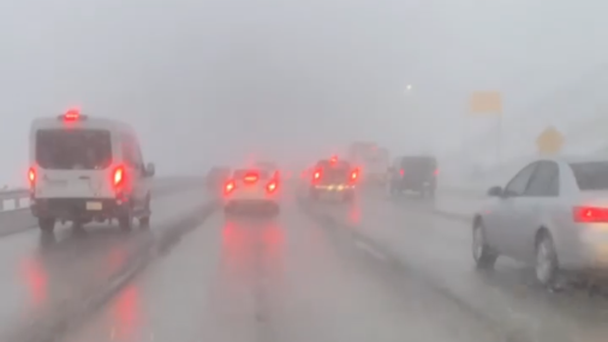
CAJON PASS, CA. (Pain In The Pass) >> Sunday afternoon cold cutoff system is moving down towards Southern California on Sunday afternoon into Monday morning with light rain showers. This storm will wrap-around Monday afternoon into the night with a chance of rain and or snow for the Cajon Pass, some parts of the high desert cities, and the mountain area, according to Southern California Weather Force.
The Southern California Weather Force, says the storm will make its way in on Sunday afternoon and will be out by early Tuesday morning. Snow and black ice may be in the Cajon Pass and on Interstate 15 for the commute.
Timing of the storm for the Inland Empire and the Cajon Pass. Rain showers off and on with heavy fog will start Sunday afternoon around 1pm-2pm. The light rain showers should start around 10pm-11pm last all day Monday. Storm estimate a total of a 1 to 2 inches of rain in the Inland Empire Valley with more at the foothills. The snow level will drop Monday late afternoon into the night. The snow level will drop to about 3,000 feet with a total of a trace to no more than two inches of snow. Please watch for ICE on the freeway and highways Monday night into Tuesday morning.


Timing of the storm for the High Desert. On and off rain showers starts around 7-8pm. The storm estimate total less than or about a half of a inch of rain. There is a chance of snow showers Monday morning into the night. The best city to see snow will be Oak Hills, Phelan, Hesperia area. Gusty winds up to 60+ mph could blow snow around.

Timing of the storm for Wrightwood Mountains. Winter Storm Warning with snow showers starts around 1-2pm. The snow level starts around 5,000 feet. On Monday afternoon the cold air hits and the snow level drops to 3,000 feet. The mountain communities will see mostly snow. The storm estimate total of 4 to 6+ inches of snow in the town, more at Mountain High Resort. Gusty winds up to 50+ mph will blow snow around. Expect black ice on Highway 138 at Hwy 2 and in Phelan too.
**Timing/Weather may change.
Please get prepared now if you travel the Cajon Pass Interstate 15 make sure you have a full tank of gas if you become stranded on the freeway. Monday afternoon – the night will be the coldest part of the storm. Remember to SLOW DOWN in the rain or in the snow. You can not see black ice on the roadway.
CHP and Caltrans will try to keep the Cajon Pass lanes free of snow, but if the weather turns bad they will close the freeway down.
There are more ways to follow the Pain In The Pass. Join the Traffic Group on Facebook with over 118,000 members. Join the NEW group on MeWe. Like us on are new page on Facebook. Follow us on Twitter and Instagram.
You must be logged in to post a comment.