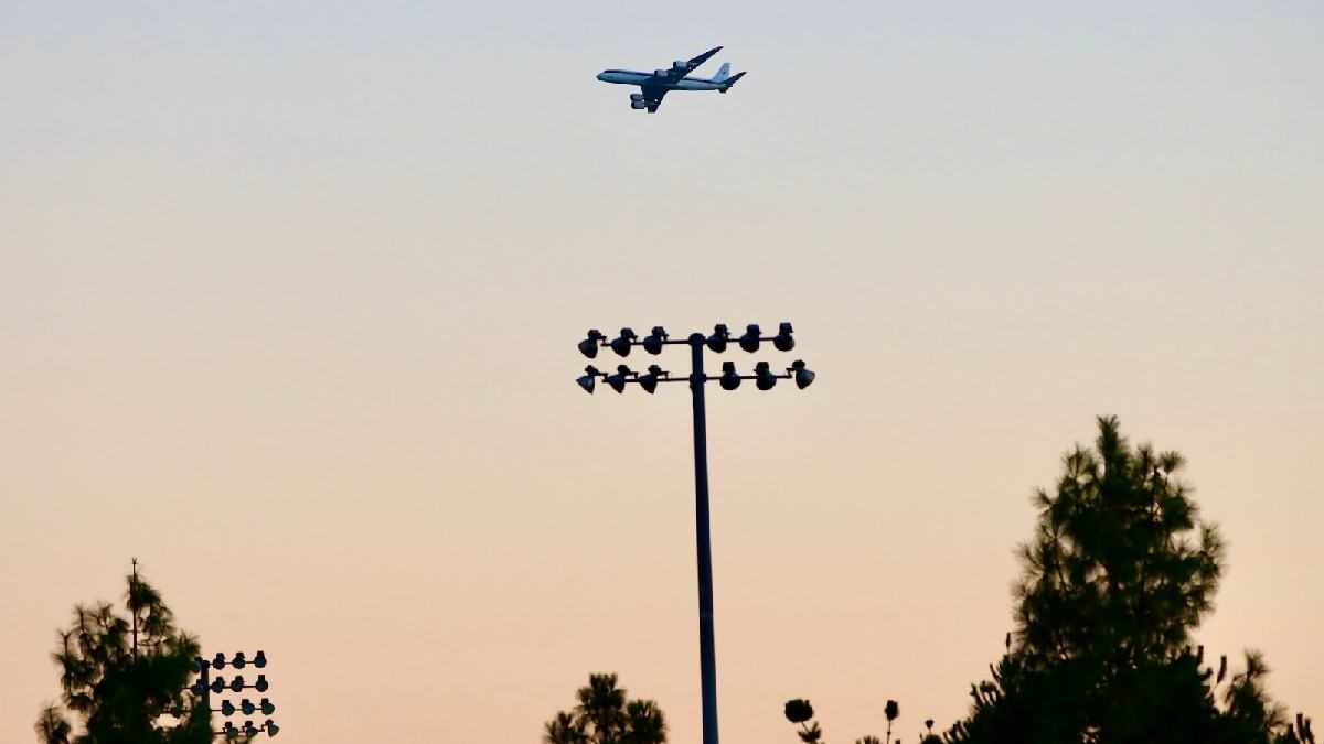
SOUTHERN CALIFORNIA, CA. (Pain In The Pass) >> Residents may have seen – or heard – the huge commercial airplane circling in and around Southern California last week. It was flying much lower than usual and for good reason. (Photo above is credit by Matt Hartman)
The NASA Armstrong Flight Research Center’s, McDonnell Douglas DC-8 aircraft flew over the Los Angeles urban area and Inland Empire Valley areas on Wednesday, Friday, and Saturday. It was part of a collaborative scientific research mission with the National Oceanic and Atmospheric Administration called AEROMMA. The plane collects data about air quality emissions in the atmosphere.
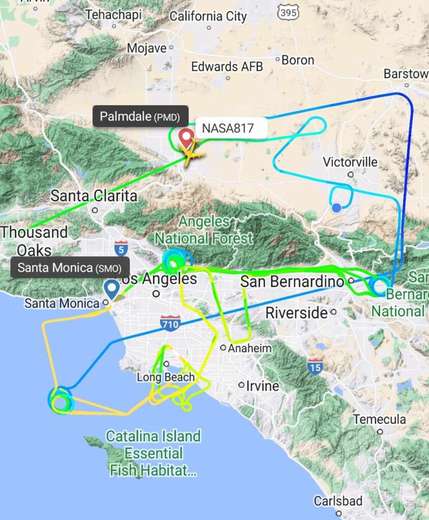
On the days flying, they zig-zagged in a flight pattern through the urban area of Southern California.
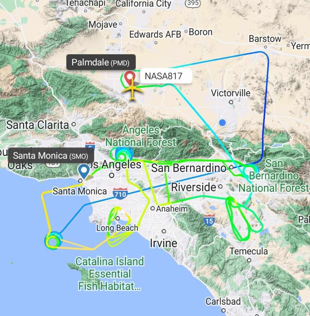
During the 6-hour to 8-hour flights on different days, the DC-8 flew at altitudes as low as 500 feet over the ocean and 1,000 feet over some parts of the valley before returning to the Palmdale Regional Airport.
The project measures Atmospheric Emissions and Reactions Observed from Megacities to Marine Areas. NASA issued news releases prior to the flights alerting residents in Los Angeles and surrounding communities that they may see and hear the aircraft as it collects data on air quality and pollution sources.
“As a large four-engine passenger jet outfitted with scientific equipment, the DC-8 aircraft will be hard to miss as it conducts these flights. Flying at a safe altitude over some of our most densely populated areas in North America,” said the statement from NASA.
“All flyovers are conducted at a safe altitude without harm to public, wildlife, or infrastructure,” the statement added. “Jet aircraft are very loud and those with sensitivity to loud noises should be aware of the flyover window.”
Over the past two weeks, the DC-8 conducted multiple flights out of Wright-Patterson Air Force Base in Greene County, Ohio, and Trenton-Mercer Airport in New Jersey before heading to California.
Data gathered from these flights will be combined with ground observations and satellite images to help NOAA scientists better understand the sources of air pollution in large cities as well as how that urban pollution can spread and impact rural areas.
The goal of the AEROMMA project is to improve air quality forecasts as well as climate models that take air pollution into account. This research is crucial in understanding and mitigating the effects of air pollution on the environment and on the health of local populations. The data collected on could take over a year to be analyzed, NASA has said.
There are more ways to follow the Pain In The Pass. Join the Traffic Group on Facebook with over 130,000 members. Join the group on MeWe. Like us on the NEW page on Facebook. Follow us on NewsBreak, and also follow us on Instagram, Threads, and X aka Twitter.