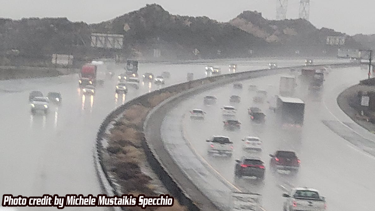
CAJON PASS, CA. (Pain In The Pass) >> The heaviest rainfall has not hit, it’s still on its way. As much as 3+ inches of rain could fall on some areas of Cajon Pass/foothill area, raising the risk of debris flows and flash flooding.
Timing of heavy rain showers for Inland Empire/Cajon Pass. Bust of heavy rain showers could start around 8pm-11pm on Friday night, then more heavy rainfall starts Saturday morning around 5am-9am. Pop-up thunderstorms are not out of the question on Saturday afternoon. This storm will bring off and on showers. Heavy fog/rain in the Cajon Pass. The Cajon Pass/foothills area could get about 3+ inches of rain total. The Inland Empire cities could get about an inch to 2 inches of rain total; each city could vary. A thunderstorm can product higher rain totals. This will result in isolated flash and urban flooding on Saturday.
Timing of heavy rain showers for the High Desert. Bust of heavy rain showers could start around 9pm-11pm late Friday night. Moderate to heavy rain showers could start around 6am-10am on Saturday morning that could be heavy at time. Pop-up thunderstorms are not out of the question on Saturday afternoon. The High Desert cities like Hesperia/Victorville could get about an inch to 1+ inches of rain total; each city could vary. A thunderstorm can product higher rain totals. Barstow will get about an inch of rain. Strong gusty winds at time.
Timing of heavy rain showers for the Mountains like Wrightwood. Bust of heavyrain showers could start around 8pm-11pm late Friday night into. More heavy rain shower Saturday morning could start around 6am-10am. This storm will bring off and on showers heavy at times. Pop-up thunderstorms are not out of the question on Saturday afternoon. Snow level will be high around 8,000 ft. then drop around 6,000+ ft on Sunday. Wrightwood will get about 3+ inches of rain total no snow in town. Mt High could get some snow on Sunday morning. Flash floods and dangerous debris flows are possible in Sheep Creek Wash in Wrightwood and in Phelan. Strong gusty winds are in the forecast.
If you travel through the Cajon Pass expect heavy traffic due to the weather condition that can change quickly. One-minute light rain then the next minute heavy rain. Remember to SLOW DOWN in the rain or in foggy conditions.
Remember Head Lights on in the rain in the daytime.
Slow down to maintain control and leave space between vehicles.
Timing of the storm could change.
There are more ways to follow the Pain In The Pass. Join the Traffic Group on Facebook with over 165,000 members. Join the group on MeWe. Like us on the NEW page on Facebook. Follow us on Instagram, and also follow us on Threads, and X aka Twitter.