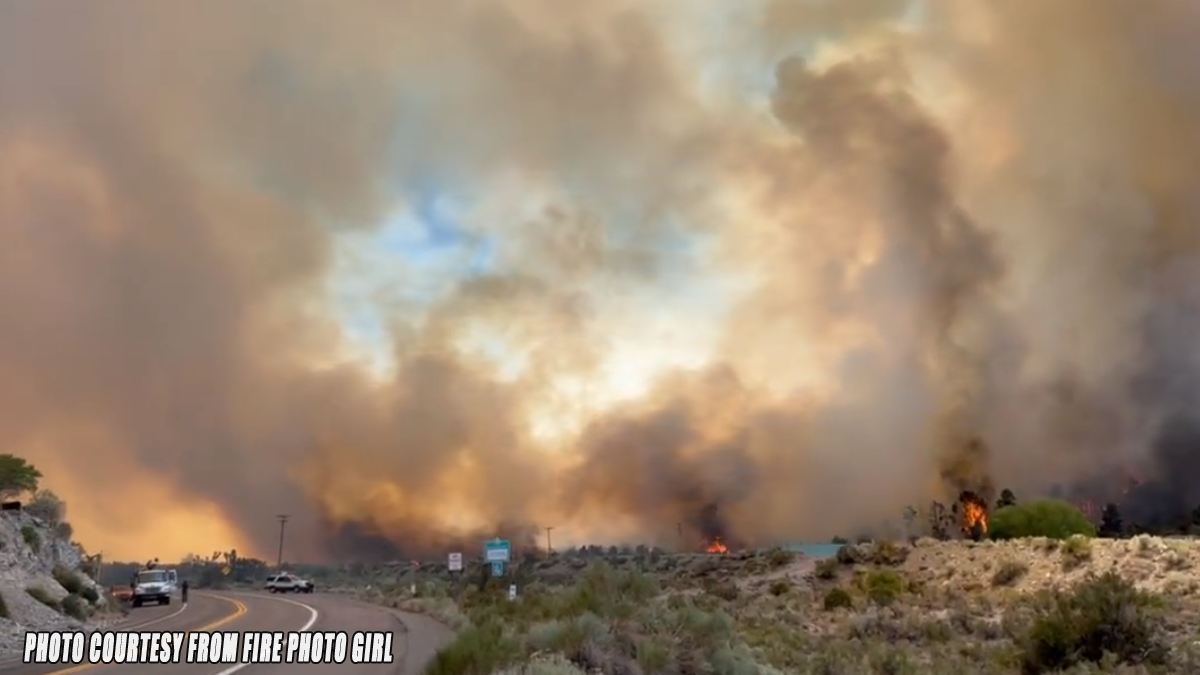
WRIGHTWOOD, CA. (Pain In The Pass) >> A wildfire burning in the mountain community of Wrightwood since Saturday evening has flared up and dramatically grown in size causing a big smoke plume you can see in the Victor Valley.

The Sheep Fire Incident was reported at about 6:29pm, on Saturday, June 11, 2022, just north of Highway 2 and started about 1 acre and grew that night.

Sunday morning, fire officials said at 8am the fire was still at 35 acres but with 5% contain and burning away from the town of Wrightwood.
At 1pm with help of gusty winds the fire woke up with a big flared up. Fire has jump across Hwy 2 going towards the east, starting evacuation orders for the Desert Front Rd. area, plus putting Wrightwood under an evacuation warning. The fire is at 45+ acres burned. Winds are blowing around 20-30 mph.

There is no smoke alert or advisory at this time. Remember if you can smell smoke you’re breathing smoke.
2:30pm the fire has grown to 150+ acres. The fire has jump Hwy 2 and making a run toward Hwy 138 at this time.
At 4:30pm There is a mandatory evacuation order in place for residents living in the community of Wrightwood. The evacuation order is for Highway 2 to Mesquite St. from Hwy 138 to Sand Canyon.

At 5pm the fire exploded to 775 acres still 5% contained.
Update at 10pm the fire is 990 acres burned and still 5% contained.
8am Monday with updated mapping the fire is 939 acres still 5% contained.
4pm Monday afternoon the fire is at 990 acres burned and 18% contained. Cooler weather help firefighters containment lines.
10pm Monday night the fire is still at 990 acres burned and 27% contained with help of the cooler weather.
8pm Tuesday the fire is 997 acres and is 35% contained and all evacuation orders have been lifted.
9pm Sunday 6/19/22 the fire is now 100% contained – Firefighters will continue patrols and mop-up to extinguish hot spots over the next several days. Swirling ash/dirt (dust-devils) may look like smoke please don’t report them. Please only report smoke or flames.
This story and size will be updated above as more information becomes available. The cause of the fire is still under investigation.
There are more ways to follow the Pain In The Pass. Join the Traffic Group on Facebook with over 110,000 members. Join the NEW group on MeWe. Like us on Facebook, Follow us on Twitter and Instagram.